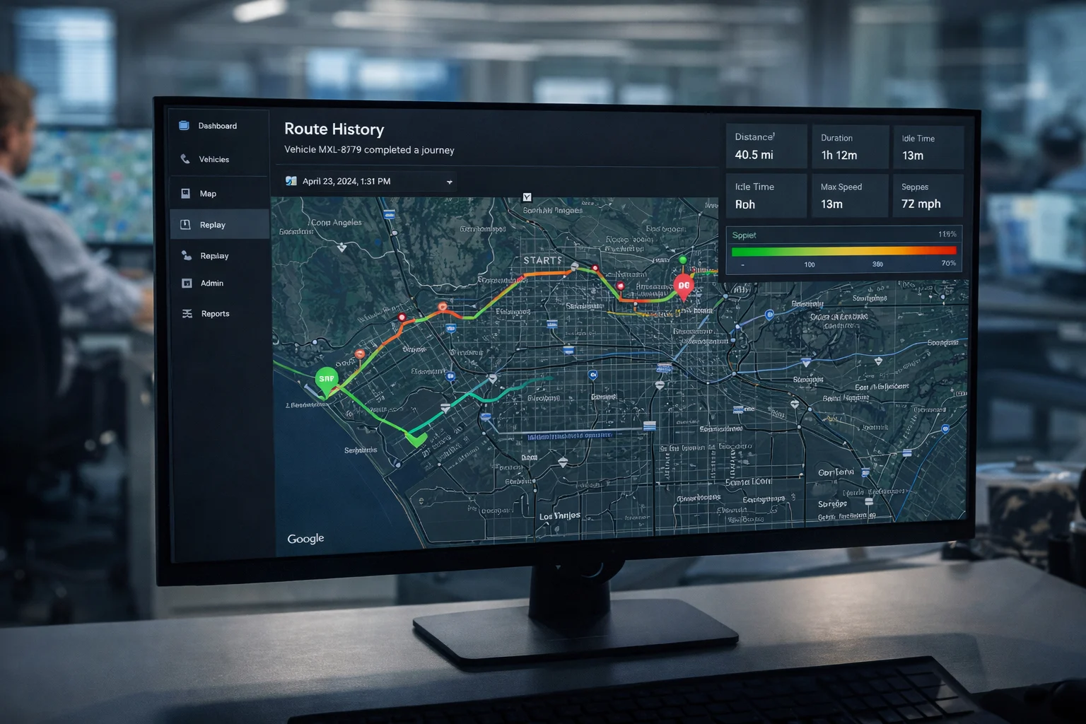
Route History
Your entire route, visualised on the map
Every trip is recorded and drawn on an interactive map with speed-based colour coding. Green for normal speed, yellow for moderate, and orange for high — giving you an instant visual read of every journey.
- Full route polyline drawn on Google Maps
- Speed-based colour coding along the entire route
- Start, end, and stop markers with timestamps
- Up to 31 days of route history per vehicle
Route History
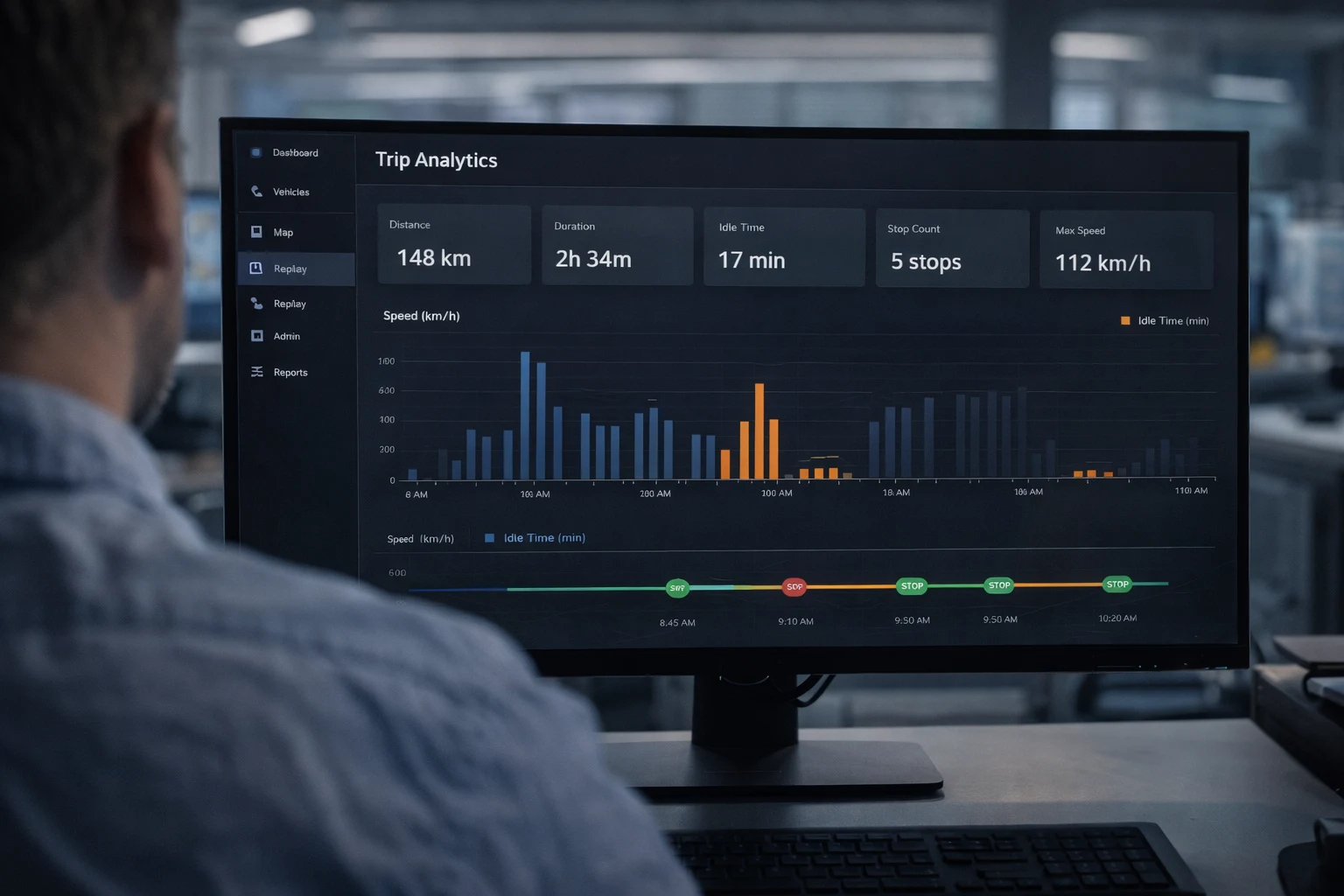
Trip analytics, stop by stop
Every trip comes with a structured summary: total distance, duration, idle time, stop count, average speed, and maximum speed. Dive into individual stops to see exact coordinates, duration, and timestamps.
- Total distance, duration, and idle time per trip
- Individual stop analysis with location and duration
- Average and maximum speed per segment
- Animated playback at adjustable speed with timeline slider